The Kentucky Transportation Cabinet selected GRW to complete a mobile mapping project along US31 West. The US 31 West project consists of approximately 9.5 miles of congested roadway running between Elizabethtown and Radcliffe, in Hardin County, KY, with the survey limits defined by the right-of-way. US31W varies from four to six travel lanes throughout the project, with additional turn lanes and medians in some areas.
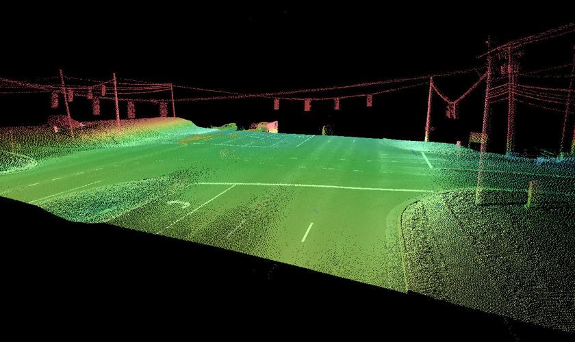
To complete the project to specifications, mobile mapping data was collected for the full corridor length by an Optech Lynx Mobile Mapping System (MMS). The MMS was outfitted with two LiDAR sensors, precise positional instrumentation, and a six?lens camera to collect digital photography to aid in data processing. Data was collected in four passes, two in each direction, to ensure full coverage of the project area.
In addition to the collection of mobile mapping data, GRW placed 33 permanent monuments along the roadway. To aid in the calibration and verification of the mobile mapping data, conventional surveys was utilized to place 101 paneled locations, visible in the LiDAR data as precise positions. Horizontal values for the paneled locations were derived from GPS RTK, with vertical values refined through the use of differential leveling.
Following the collection of mobile and control data, the full LiDAR dataset was calibrated to remove any systematic errors and to account for areas of weaker GPS signal in areas obstructed by overhead features. Roughly half of the paneled positions were read as known points, with the remaining points withheld to be utilized as verification points. Following calibration, the dataset yielded an RMSE of 0.04’, with no outliers.
With calibration complete, GRW utilized TopoDot and TerraScan software to extract DTM and planimetrics features from the LiDAR data. DTM consisted of cross sections every 5’, with breaklines added for curbs and other significant breaks. Planimetric features consisted of guardrails, signage, above ground utility features, and road features. Final delivery for US31W will be made to meet the client's specifications, with all data delivered in MicroStation and SelectCad formats.
Quick Turnaround: GRW completed four passes (two northbound, two southbound), resulting in a total of nearly 600 million collected XYZ locations. Once calibration was completed, an extensive list of survey features were extracted from the dataset, including elevation data, signage, guardrails, signal lights, and pole locations. Starting with a massive dataset (15.1 gb), the final deliverable data fit into a single MicroStation file of lines, cells, and text that can be easily manipulated on a standard workstation.