 Lexington-Fayette Urban County Government Floodplain Mapping, Lexington, KY
GRW completed a detailed digital floodplain redelineation project including the creation of new Digital Flood Insurance Rate Maps (DFIRMs) for Lexington-Fayette County, KY, and profiles in compliance with the standards from FEMA’s new Map Modernization Program.
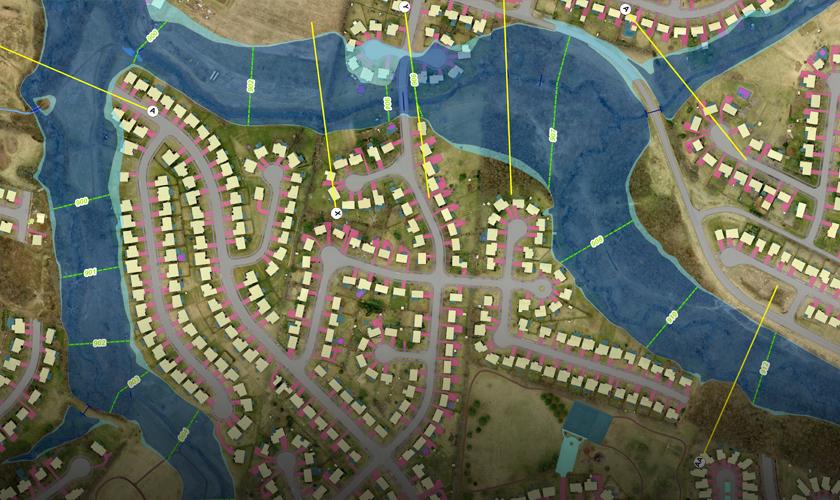
As part of this project, GRW started with the information from prior LFUCG flood studies accomplished by GRW. We converted the elevations from the National Geodetic Vertical Datum (NGVD29) to the North American Vertical Datum (NAVD88). We then used 3D analysis software to intersect the new flood elevations with the high accuracy Digital Terrain Model (DTM) that GRW helped create as part of the LFUCG mapping project. The project covered over 70 miles of stream centerlines.
The result was new detailed DFIRMs that defined the floodway, 100- year flood zone and 500-year flood zone with much greater detail and precision than the original Flood Insurance Rate Maps. The final data was delivered to LFUCG in ESRI Shape File format in compliance with FEMA standards. The final DFIRM panels were generated from the GIS database using the ESRI ArcGIS suite of products.